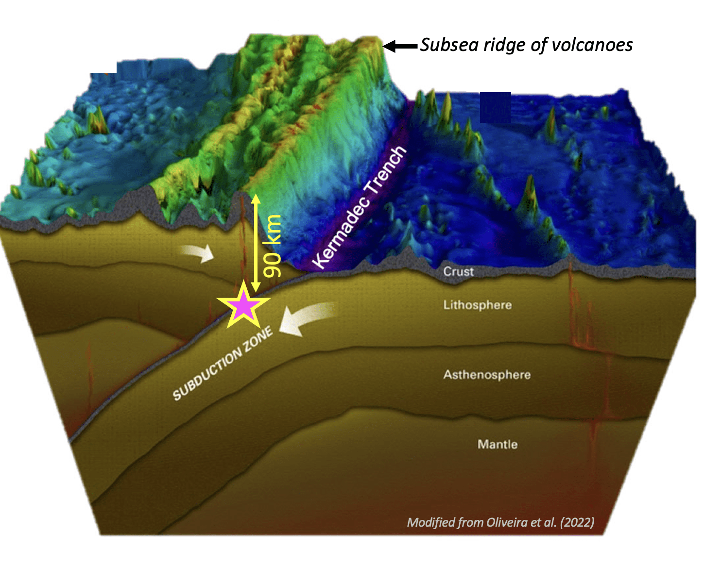
Last evening, local time, all stations of our network recorded seismic waves from an earthquake to our North and East toward the Kermadec Islands. We get many earthquakes from this area, as it’s on the boundary between the Pacific and the Australian tectonic plates. (For more info, visit this page.)
Below are the screenshots of the recordings from 4 of our stations. From top to bottom they are: Kiwi North Museum in Whangārei, Te Kura o te Pāroa in Whakatāne, Waimea College in Nelson, and the Otago Museum in Dunedin. The stations are ordered from North to South. Can you spot the differences?
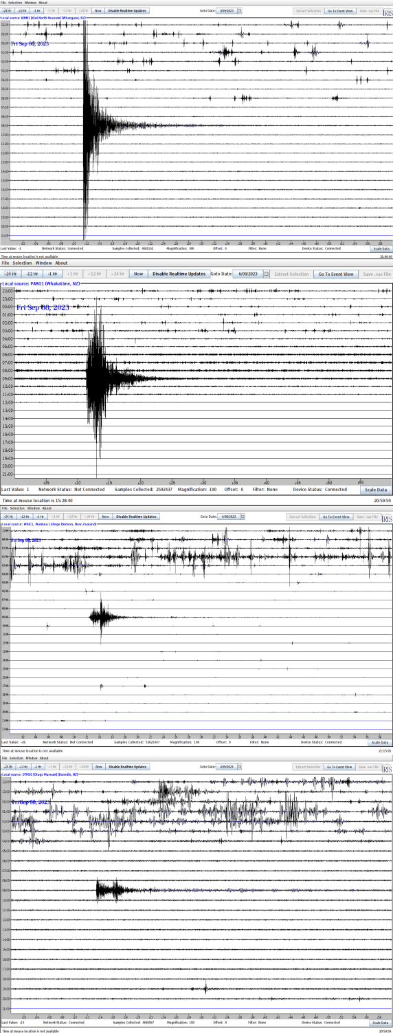
In all snapshots the earthquake signal stands out against the noise earlier in the day. The noise was from you all leaving school/museum, but the earthquake arrived at your station when there was nobody in the building.
As the seismic waves move across Aotearoa from North to South the amplitude decreases, because the energy in the seismic waves decrease away from the earthquake.
But do you see another pattern happening from North to South? In the North, the seismic energy looks like a sharp triangle, but as you go further South two separate triangles emerge! This is because earthquakes generate many seismic waves. Have you heard of P- and S-waves? The P-waves are faster than the S-waves, but close to the Earthquake the P-wave has not had time to outrun the S-wave. Further away from the Earthquake the difference in speed between these waves becomes very clear.
If you made it this far in this post, maybe you want to know a bit more. What we said in this post is true, but the devils is always in the details. Because the earth is not homogeneous, the wave propagation is complicated. In addition to the attenuation of the waves and the splitting of the different arrivals, seismologists will study this earthquake to learn more about the earth between the Kermadecs and here. For example, the distance between the Earthquake and Whangarei is not very different to the distance between the Earthquake and Whakatane! So why are their signals different? It is because the waves “saw” different rocks on their way.